Details: Fancy Pass - Missouri Pass 
Distance: 8.1 miles (loop)
Holy Cross Wilderness, White River National Forest, near Leadville in Central Colorado
By: Diane Greer
Hike Facts
- Distance: 8.1 miles (loop)
- Elevation: 10,000-ft. - 12,380-ft.
- Elevation Gain: 2,380-ft.
- Difficulty: moderate-strenuous
- Trail Highlights: See Trail Intro
- Basecamp(s): Leadville
- Region: Central Colorado
This great loop hike climbs to two scenic passes and visits a pair of gorgeous lake basins surrounded by 13,000-ft. granite peaks and ridges in the Holy Cross Wilderness.
Trailhead to Fancy Pass
Distance from Trailhead: 6.0 miles (round trip)
Ending/Highest Elevation: 12,380-ft.
Elevation Gain: 2,380-ft.
I recommend hiking this loop trail in a counter-clockwise direction, ascending the Fancy Creek drainage and returning via Missouri Creek.
From the Fancy Creek trailhead (see driving directions) the trail climbs moderate to steep switchbacks up a forested hillside, winding its way to the Fancy Creek drainage at 0.8 miles. The trail then crosses the Zen Bridge to the northeast side of Fancy Creek. Beyond the bridge the grade abates as the trail travels through spruce-fir forests, staying well above the creek.
At 2.0 miles the path traverses a pretty meadow then climbs steeply to Fancy Lake, gaining 400-ft in 0.3 miles. Fancy Creek cascades down a rocky gorge below the trail. The pretty lake, located at timberline, is ringed by granite peaks and crags.
At the lake the trail turns right (northeast) and climbs a steep gully up the hillside running along the north side of the lake. At the top of the hill reach a trail junction. The trail to Holy Cross City heads right (northeast), our trail turns left (northwest), following an old road grade that climbs steeply up a rocky ravine to Fancy Pass (12,380-ft.), gaining over 700-ft. in 0.6 miles. Just below the pass some old mining ruins are scattered around the ravine.
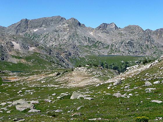
From the pass views to the southwest encompass the head of the Cross Creek valley, clad in beautiful meadows dotted with lakes and surrounded by granite peaks. The large lake in the distance is Blodgett Lake while the nearby lake, just below Missouri Pass, is Treasure Vault Lake.
Completing the Loop - Missouri Pass and Back to the Trailhead
Distance from Trailhead: 8.1 miles (loop)
Ending/Highest Elevation: 12,380-ft.
Elevation Gain: 2,380-ft.
To complete the loop follow the trail as it descends from the pass to the valley. In the valley the path turns southwest, passing small tarns as it wanders through rocky meadows filled with wildflowers. To the northwest views open to the jagged granite peaks and ridges lining the western wall of the upper Cross Creek valley.
At 3.7 miles reach the junction with the Cross Creek trail, heading right (west). Our path bears left (south) toward Missouri Pass. A short distance after the junction the trail passes to the left (east) of Treasure Vault Lake, an azure gem nestled in pretty meadows at the head of the basin. Past the lake the path starts a short steep climb to Missouri Pass.
Reach Missouri Pass (11,986-ft.) at 4.0 miles. From the pass enjoy expansive views of the upper Cross Creek valley and the beautiful Missouri Lakes basin to the southeast. The basin, covered in rocky knobs and emerald green meadows, lies just below the timberline in an oblong cirque of granite ridges and peaks anchored to the southwest by Savage Peak (13,139-ft.).
After taking in the views descend from the pass to the basin. The steep trail arrives at the first of the Missouri Lake after losing 440-ft. in 0.4 miles. The second and largest lake is 0.2 miles further. The trail then passes between two smaller lakes before arriving at fifth lake located 1.0 mile from the pass. Another large lake, reached by a spur trail heading right (southwest) just beyond the fifth lake, is situated directly beneath the northeastern flanks of Savage Peak.
Pockets of trees scatter throughout the meadows in the basin harbor nice campsites. Please remember to camp at least 100-ft. from streams and lakes.
Past the fifth lake the trail follows Missouri Creek, descending on moderate grades through conifers to a large meadow at 6.6 miles (2.6 miles from Missouri Pass). Beyond the meadow the grade steepens and the trail crosses the creek several times, passing pretty cascades and waterfalls along the way. The final creek crossing is at the mouth of a small scenic canyon.
The final leg of the trail passes diversion dams and water pipes that are part of the Homestake Water project. The project, built in the 1960’s, transfers water to the Cities of Aurora and Colorado Springs.
Shortly after passing the diversion dam and just before reaching the road look for a trail heading left. The trail leads through the woods and back to your car. Alternatively you can walk down to the road, turn left and walk back to the Fancy Pass trailhead on the road, a distance of 0.7 miles.
Elevation Profile

Buy the BookThis opinionated guide includes all the hikes in the Aspen, Buena Vista, Crested Butte, Marble and Leadville sections of the website plus info on local services and nearby attractions. | |

Driving Directions
Driving Directions from Leadville: Travel north on Highway 24 for 19.5 miles to Homestake Road #703. Turn left and follow the road for 8.5 miles, passing the Gold Park Campground along the way. Turn right onto Homestake Road #704 and continue 3 miles on this dirt road to a "T" intersection at 10,200 ft. Turn right and the trailhead will be on the left.
Driving Directions from Vail: Travel west on I-70 to Exit #171 for Minturn, Leadville, and Hwy 24. Exit here and turn right onto Hwy 24. Proceed south for 13 miles to Homestake Road #703. Turn right and follow the road for 8.5 miles, passing the Gold Park Campground along the way. Turn right onto Homestake Road #704 and continue 3 miles on this dirt road to a T intersection at 10,200 ft. Turn right and the trailhead will be on the left.
Trail Resources
Trail Intro / Trail Photo Gallery / Trail Map
Basecamp(s) Information:
Leadville
Region Information:
Central Colorado
Other Hiking Regions in:
Colorado