Boquillas Canyon
Don’t miss this scenic hike to the mouth of Boquillss Canyon, a dramatic limestone gorge through the Sierra Del Carmen Mountains. Here the Rio Grande flows beneath the mountain’s soaring cliffs and rugged walls. Caves, fossils and grinding holes add interest to the hike.
- Distance: 1.4 miles (RT)
- Elevation: 1,836-ft. at Trailhead
Maximum elevation - 1,918-ft. - Elevation Gain: 82-ft.
- Difficulty: moderate
- Basecamp: Big Bend
- Region: Texas Parks
Trail Description - Boquillas Canyon
This trail leads to the entrance of Boquillas Canyon, a magnificent limestone gorge carved by the Rio Grande through the Sierra Del Carmen Mountains. The canyon, located at the southeast corner of the park, is the longest of the three major canyons in the park. The southern half of the canyon is on the Mexican side of the border and is protected by the Maderas Del Carmen Protected Area.
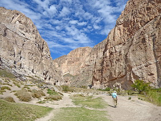
Starting from the end of the Boquillas Canyon spur road the trail climbs on moderate to moderately-steep grade to an overlook atop a low ridge at 0.1 miles. Here great views encompass the entrance to Boquillas Canyon, the Sierra Del Carmen Mountains, the Rio Grande and the village of Boquillas, Mexico to the west.
From the overlook the trail drops down to the floodplain along the river at 0.25 miles. Here a two path, one near the river and one a little higher, head east toward the entrance to the canyon. (Both paths lead to the same destination.) Along the way look for ancient fossils and pre-historic grinding holes used by indigenous inhabitants in food production.
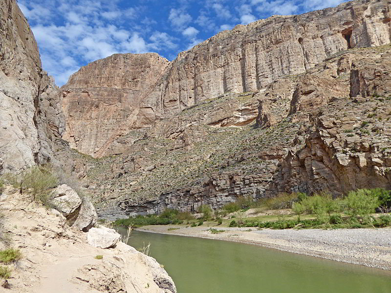
At 0.4 miles the floodplain narrows as the path curves to the left (northeast) around the foot of a ridge. Beyond the curve the floodplain again widens and the canyon’s walls tower overhead. Along the base of sheer cliffs are small caves and sand dunes blown by prevailing winds.
As the canyon constricts the floodplain narrows and then disappears. Here the path climbs gently up talus slopes to its ends at a viewpoint along the mouth of the canyon at 0.7 miles. Ahead are dramatic views of sheer cliffs rising above talus slopes on the south side of the river.
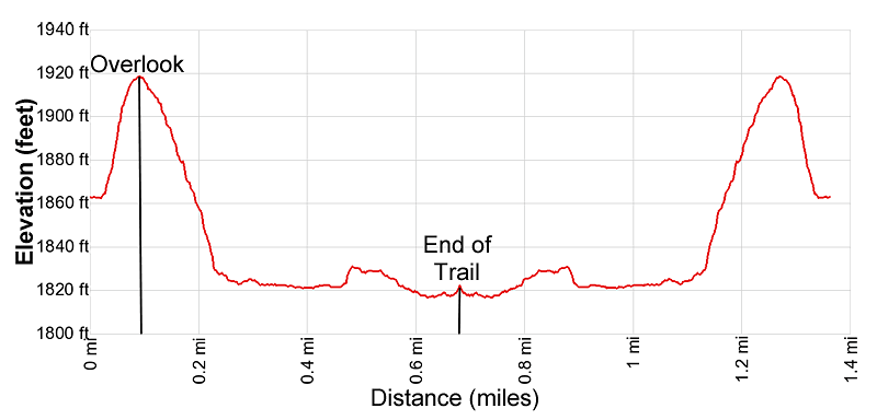
Elevation Profile
Driving Directions
From the Big Bend National Park Headquarters at Panther Junction: From Panther Junction, at the intersection of the Persimmon Gap Road and the Rio Grande Village Road, head southeast on the Rio Grande Village Road toward Rio Grande Village. Follow the road for 19.3 miles and then turn left on the Boquillas Canyon Road. Follow the Boquillas Canyon Road for 3.6 miles to the end of the road at the Boquillas Canyon trailhead.
From the Chisos Mountain Lodge area: Head northeast on Chisos Basin Road for 6.4 miles and then turn right onto the West Entrance Road. Follow the West Entrance Road for 3.2 miles to the “T” intersection at Panther Gap. Continue straight ahead on the Rio Grande Village Road toward Rio Grande Village. Follow the road for 19.3 miles and then turn left on the Boquillas Canyon Road. Follow the Boquillas Canyon Road for 3.6 miles to the end of the road at the Boquillas Canyon trailhead.
Trail Resources
- Trail Photo Gallery
- Trail Maps
- Basecamp(s) Information: Big Bend
- Region Information: Texas Parks
- Other Hiking Regions in: Texas